
Pennsylvania Turnpike Commission GeoBIM Implementation
/Client: Pennsylvania Turnpike Commission
Location: Pennsylvania
Challenge
The Pennsylvania Turnpike Commission (PTC) oversees the planning, design, and construction of one of the most extensive transportation systems in the U.S. Responsible for efficient and reliable travel for millions of motorists, PTC continuously seeks to leverage cutting-edge technology to enhance its infrastructure management.
One of the most pressing challenges in the architecture, engineering, and construction industry is improving communication and collaboration across numerous design and construction projects. Like many in the industry, PTC faces the growing complexity of modern infrastructure. Historically, PTC relied on separate systems for geographic information systems (GIS) and building information modeling (BIM), which resulted in data silos and hindered stakeholders’ ability to visualize projects in a location-based context, making it difficult for maintenance staff to accurately analyze clashes with other infrastructure, manage issues efficiently, and access BIM files.
PTC’s engineering department and the information technology customer and business solutions team recognized that integrating GIS and BIM could unlock new opportunities for enhancing project management, reducing risks, and improving project outcomes. But where to find a solution that could combine the power of BIM’s detailed 3D models with the spatial GIS context, while also leveraging PTC’s existing Esri® and Autodesk investments?
Solution
PTC partnered with GeoDecisions to implement Esri’s ArcGIS GeoBIM solution. GeoDecisions brought extensive experience in geospatial data and technology integration to realize PTC’s vision of a fully integrated digital delivery platform.
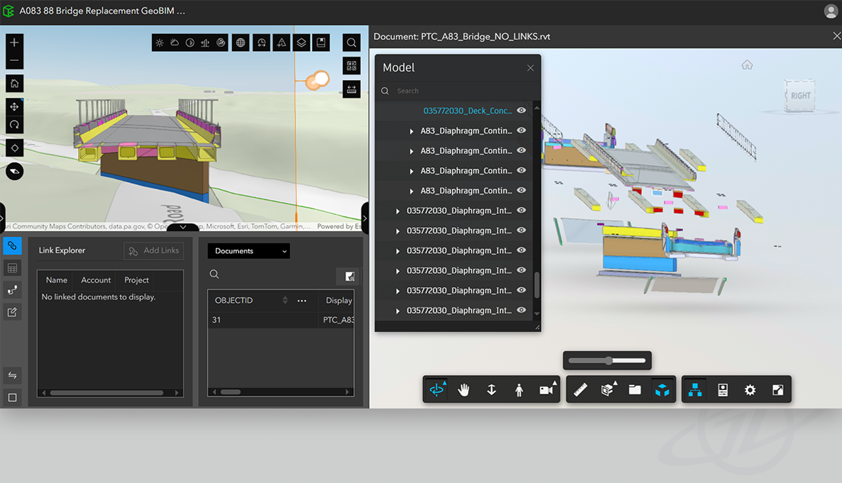
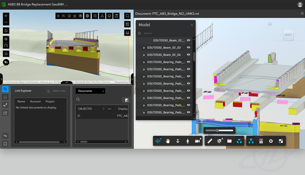
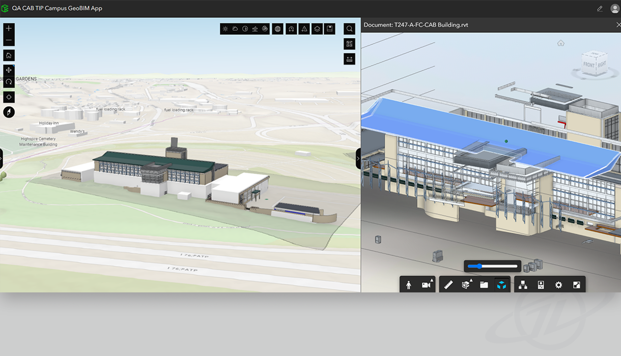
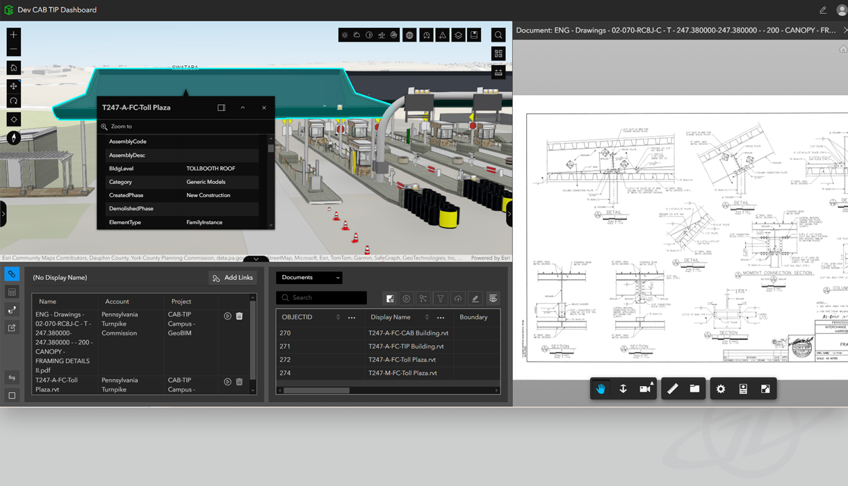
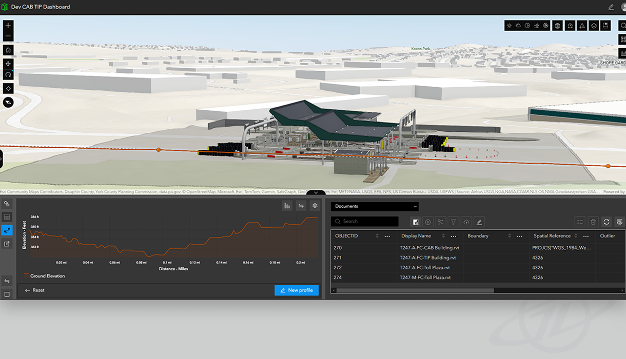
The ArcGIS GeoBIM solution bridges the gap between BIM and GIS, enabling data visualization in real-world environments. By integrating data sets from multiple sources, including Esri and Autodesk’s platforms, the solution provides a comprehensive project view and allows PTC to move beyond isolated project information. This integration allows stakeholders to see how individual project components interact with the surroundings, offering critical insights throughout the project lifecycle — from initial design through construction to long-term asset and facility management.
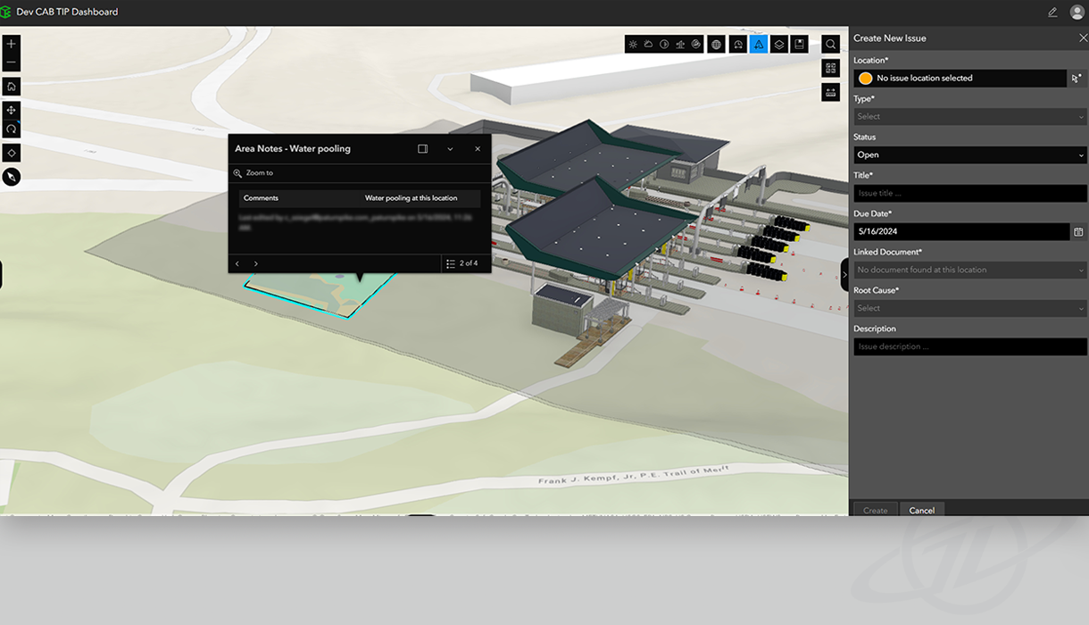
A key feature is the ability to convert BIM models into Esri scene layers that can be used in various 3D GIS environments. This capability provides users without specialized licenses the ability to interact with project models through the 3D Scene Viewer, facilitating broader access and collaboration. The capacity to track issues directly from the field into the 3D models within the ArcGIS GeoBIM environment further enhances the accuracy and responsiveness of PTC’s project management processes.
GeoDecisions collaborated with PTC’s geoanalytics team to configure and tailor the ArcGIS GeoBIM platform, resulting in a centralized project data hub, increasing collaboration, information sharing, and informed decision-making based on a holistic project view.
Key Technologies
Autodesk Construction Cloud
Autodesk Revit
Bentley Open Roads
Esri ArcGIS Online
Esri ArcGIS GeoBIM
Esri 3D Scene Viewer
Autodesk 360
Key Takeaways
Enhanced collaboration: breaking down data silos, enabling better communication and stakeholder coordination, facilitating more informed decision-making, and reducing risk.
Improved efficiency: seamless BIM and GIS integration streamlines processes, providing a unified view, reducing redundancy, and enhancing efficiency.
Strategic innovation: embracing digital innovation for designing and constructing critical infrastructure, addressing current project needs, and future-proofing operations.
Scalability and flexibility: easy integration of 3D BIM modeling and GIS data, increasing return on investment.


